The modern atlas for wine exploration
Navigate appellations, discover terroirs, and understand wine geography with an interactive map built for professionals, students, and enthusiasts.
No account required · Free to use · Updated weekly
Everything you need to explore wine regions
A comprehensive toolkit for understanding the geography of wine, from global overviews to detailed appellation boundaries.
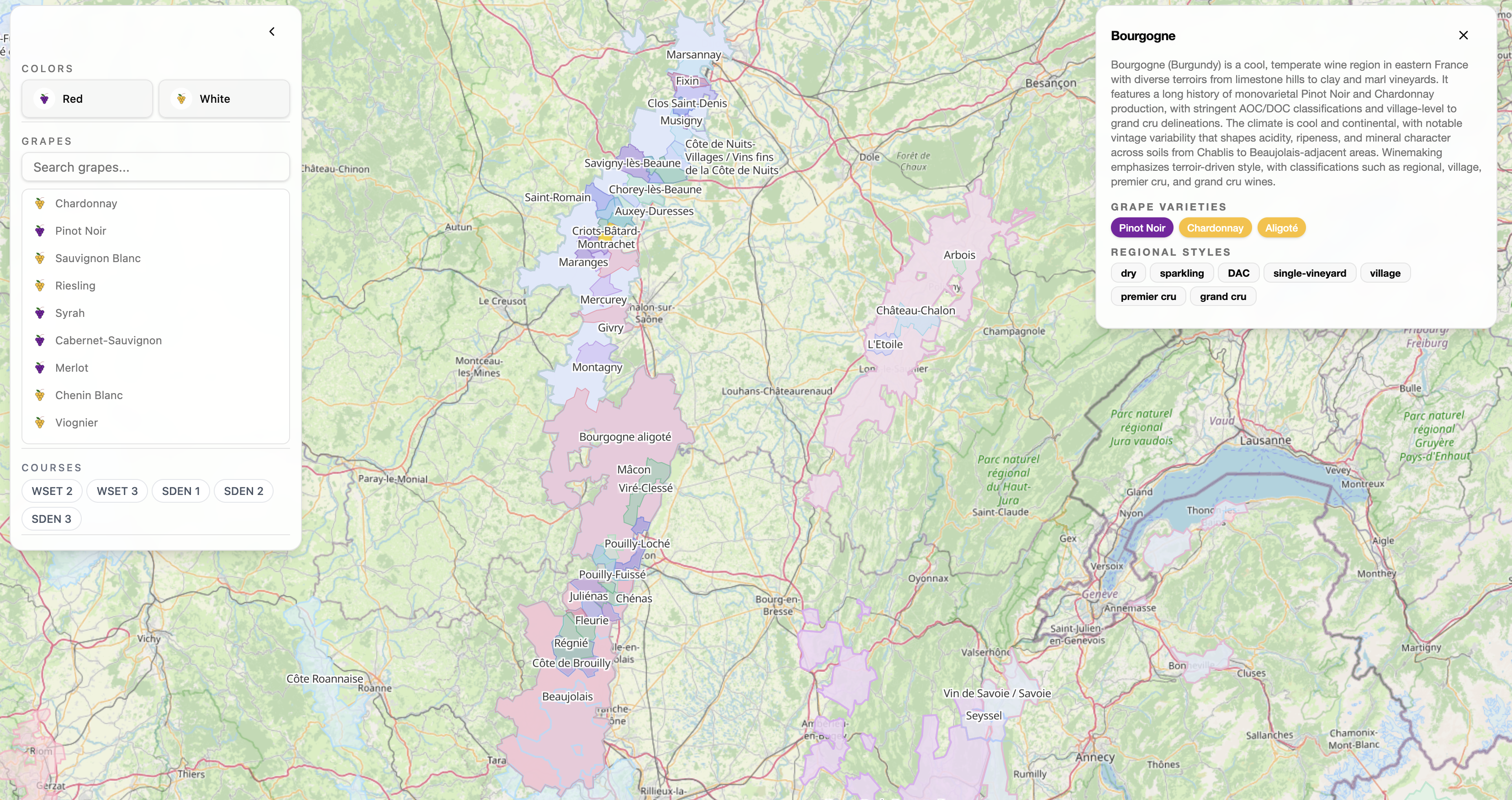
Global Coverage
From Bordeaux to Barossa, Napa to Niagara. Every major wine region mapped with official boundaries.
Study Visually
Accelerate learning by seeing the different wine regions to help you study for your WSET or SDEN course.
Smart Filters
Filter by grape variety, color or certification. Find exactly what you're looking for.
Instant Search
Type any region, appellation, or grape name. Jump directly to any location on the map.
Region Details
Click any region to see key grapes, styles, climate data, and links to official sources.
Always Current
Built from official data sources and updated regularly as new appellations are recognized.
From continental patterns to individual vineyards
Zoom seamlessly from a global view down to specific vineyard plots. Our multi-scale approach lets you understand wine geography at every level.
- EU
- USA
- Australia
- South America
- New Zealand
- South Africa
Bordeaux
France
Tuscany
Italy
Napa Valley
USA
Rioja
Spain
Built on trusted data sources
We aggregate official geographic data from regulatory bodies worldwide and transform it into a seamless, interactive experience.
All major regions included
Data from across the globe
Unified Format
Boundaries are reprojected, harmonized, and optimized for smooth web rendering.
Live Updates
New appellations and boundary changes are incorporated as they're officially recognized.
Ready to explore the world of wine?
Open the map and start navigating wine regions from around the globe. No sign-up required.